

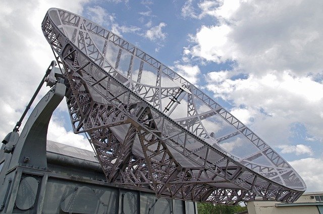
The Mt Stapylton radar is an essential piece of meteorological infrastructure situated in Queensland, Australia. Operated by the Australian Bureau of Meteorology (BoM), this radar is a linchpin in the national radar network, providing critical data for weather monitoring and forecasting. Its strategic location and advanced technology enable it to play a vital role in safeguarding the communities of southeastern Queensland and beyond.
Location and Coverage
Nestled atop Mt Stapylton, the radar enjoys a strategic vantage point that allows it to survey a wide expanse of southeastern Queensland, including the densely populated Brisbane metropolitan area, the bustling Gold Coast, and extending to parts of northern New South Wales. The radar provides comprehensive coverage at multiple ranges:
- 64 KM Range: At this close range, the radar delivers high-resolution data, essential for identifying small-scale weather patterns and phenomena such as localized thunderstorms, hail, and heavy rainfall. This range is particularly useful for urban areas where detailed monitoring can help mitigate the impacts of severe weather on densely populated regions.
- 128 KM Range: This intermediate range is optimal for tracking the development and movement of larger storm systems. It allows meteorologists to monitor weather patterns that can affect broader areas, including suburban and rural regions surrounding Brisbane and the Gold Coast. This range is crucial for early warning systems, giving communities more time to prepare for incoming weather.
- 256 KM Range: At this extended range, the radar can detect and track significant weather systems such as tropical cyclones, large storm fronts, and widespread rainfall events. This coverage includes a substantial portion of southeastern Queensland and northern New South Wales, making it invaluable for regional weather forecasting and disaster management.
- 512 KM Range: The radar’s maximum range offers an extensive overview of large-scale weather patterns and systems. While the resolution decreases at this distance, it remains an essential tool for tracking the broader movement of weather systems as they approach or move away from the region. This range is particularly useful for long-term forecasting and for monitoring weather systems that may eventually impact the local area.
By leveraging these varying ranges, the Mt Stapylton radar provides a detailed and dynamic picture of weather conditions across southeastern Queensland and beyond, enhancing the ability of meteorologists to deliver accurate and timely forecasts.
Technological Sophistication
The Mt Stapylton radar employs state-of-the-art Doppler radar technology. Unlike conventional radars that merely detect precipitation, Doppler radar can measure the velocity of precipitation particles. This capability is indispensable for identifying and analyzing wind patterns, storm rotations, and other dynamic weather phenomena. For instance, the radar’s ability to detect the speed and direction of rain droplets allows meteorologists to discern the presence of severe weather conditions, such as tornadoes, well before they cause damage.
The radar operates by emitting pulses of microwave energy that bounce off precipitation particles. By analyzing the returned signals, the radar can determine the location, intensity, and movement of precipitation. This data is then processed to create detailed images and animations that meteorologists use to monitor weather conditions in real-time.
Critical Usage
The data provided by the Mt Stapylton radar is indispensable for a variety of applications. During the storm season, when southeastern Queensland is prone to severe thunderstorms and cyclones, the radar becomes a critical tool for issuing weather warnings and alerts. Meteorologists rely on the radar’s real-time data to track the development and progression of storm systems, enabling them to provide timely warnings to the public and emergency services.
For instance, in the event of a severe thunderstorm, the radar can identify areas of intense rainfall and potential hail. This information allows meteorologists to issue specific warnings, helping communities to take necessary precautions. Similarly, during cyclone events, the radar’s ability to monitor wind patterns and precipitation helps in predicting the cyclone’s path and intensity, which is crucial for evacuation planning and disaster response.
Data Accessibility
One of the most significant benefits of the Mt Stapylton radar is the accessibility of its data. The Bureau of Meteorology makes radar images and data available to the public through its website and various weather applications. This accessibility empowers individuals, businesses, and organizations to stay informed about current weather conditions and make informed decisions.
For example, farmers can use radar data to plan their activities, ensuring that crops are protected from severe weather. Airlines and airports rely on the radar for flight planning and safety, while construction companies use it to schedule outdoor work. The general public can access radar images to plan daily activities, such as commuting, and to stay safe during severe weather events.
Importance and Impact
The Mt Stapylton radar is not just a technological marvel; it is a critical asset that enhances the safety and resilience of the communities it serves. Its ability to provide accurate and timely weather information has far-reaching implications for public safety, agriculture, aviation, and various other sectors.
In recent years, the frequency and intensity of extreme weather events have been on the rise, underscoring the importance of advanced weather monitoring systems like the Mt Stapylton radar. Climate change is contributing to more volatile weather patterns, making it imperative to have reliable tools for forecasting and responding to these changes. The radar’s data helps meteorologists to study these patterns, contributing to the broader understanding of climate change and its impacts.
End Note
In conclusion, the Mt Stapylton radar stands as a beacon of technological advancement and public service in Queensland. Its strategic location, advanced Doppler technology, and wide accessibility make it an indispensable tool for weather monitoring and forecasting. By providing critical data that informs weather warnings and helps mitigate the impacts of severe weather, the Mt Stapylton radar plays a pivotal role in protecting lives, property, and the environment. As weather patterns continue to evolve, the radar’s importance will only grow, ensuring that southeastern Queensland remains prepared and resilient in the face of nature’s challenges.